
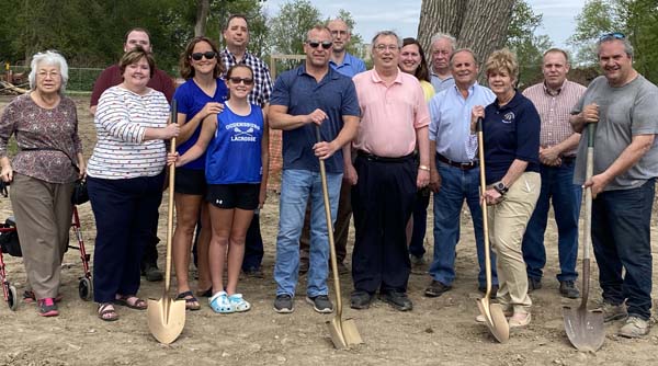

The Fort La Presentation Association has announced the selection of TJ Fiacco Construction, LLS of Norwood as low bidder for a major shore restoration and flood prevention plan for fort property bordering the St. Lawrence and Oswegatchie on Van Reenselear Point.
The project was made possible through a $1,230,250 Lake Ontario Resiliency and Economic Development Initiative (REDI) grant. The association is responsible for $64,750. The grant was developed by Gov. Andrew Cuomo to prevent flooding on property within the Lake Ontario watershed and along the St. Lawrence River, offering state resources to repair flood damage as has occurred on the fort property since October of 2017.
The association’s property received a great deal of flooding during the spring of 2019 and the association feared even more damage would occur in future flooding, endangering improvements which have been completed on the property including landscaping, walking trails, and green space.
There were several options for remediation including building a concrete barrier wall between the river and the shore, placing riprap along the shoreline or installing a large earthen berm akin to a hedgerow in a farmer’s field to deflect waves. Each appeared to have flaws. Some would take away from the aesthetic value of the river shoreline and some would limit access to the shore and perhaps even lend itself to be a liability that the association would be responsible for.
The association’s property presented a challenge to the team. Not only was it flanked by the St. Lawrence River on its left bank, but also the Oswegatchie River on its right. The Oswegatchie presented problems of bank erosion jeopardizing the vitality of the mature trees along the shoreline. The St. Lawrence, on the other hand, presented shoreline degradation and flooding problems due to force of wind, water levels and prevailing currents.
The uniqueness of the two shorelines warranted differing solutions to protect the rivers and association property. Also of concern was the preservation of the scenic beauty of the St. Lawrence and the historic value of the Oswegatchie.
The Association began working with Andy Rymph and his team of engineers at The Chazen Companies, a multi-disciplinary consulting firm located in Troy, NY; and Mark Spaulding of the New York State Department of Parks, Recreation and Historic Preservation in a search for a better option.
The initial phase of the team’s work was to create an engineer’s report that evaluated the effectiveness of design options for resiliency, environmental protection, flood prevention and socio-economic benefit. The team’s preferred plan was then reviewed with the regulatory authorities and presented to Parks and the REDI Commission for their consideration and endorsement.
Following the study, detailed plans were developed for local and state permitting involving the City of Ogdensburg, the NYS Department of Environmental Conservation, NYS Department of State and the U.S. Army Corps of Engineers.
The western shore of the Oswegatchie River is the eastern boundary of the association property. Erosion has worn away a large portion of the riverbank. This endangers the historical aspect of the property as well contributing to the loss of trees along the bank which, in turn, will provide opportunity for more bank erosion in the future.
After careful examination it was determined that to resolve the erosion damage, it would be beneficial to devise different methods for bank stabilization and erosion control based on the effects the river has on particular sections of the shoreline. As the Oswegatchie flows under the twin bridges, the river enters a curve due to speed of flow and the degree angle of the shoreline. The westerly bank is where the worst erosion occurs.
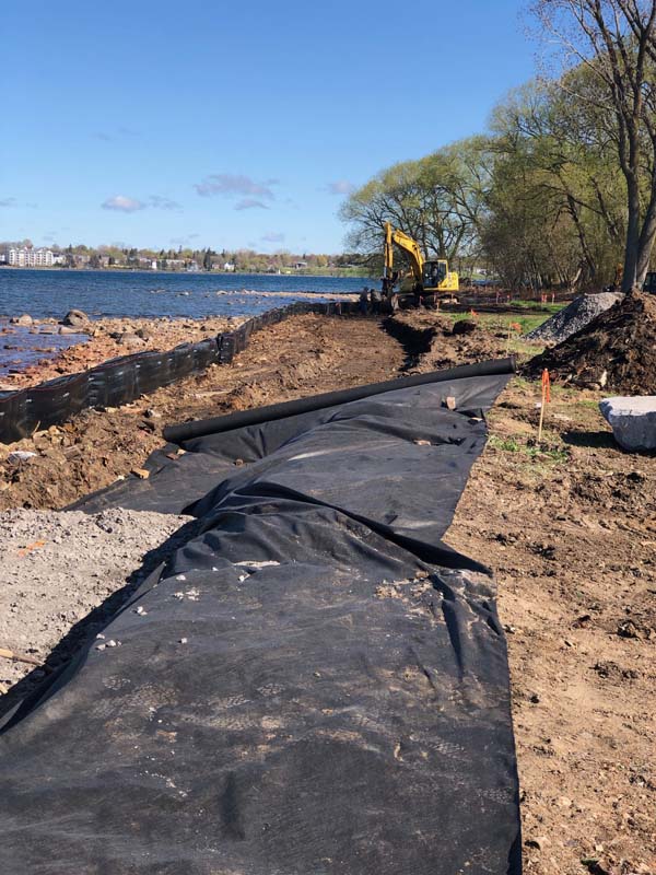
The proposal for a natural shoreline restoration plan requires temporary cofferdams to allow for a limited amount of excavation to ensure a level platform to lay toe wood/stone material. Toe wood barriers are made of tree trunks with the root system exposed, extending out from the shoreline and anchored in place by pinning or large stone. It is then covered by a layer of organic matting. Toe stone is layers of heavy slab stone lined along shoreline to reduce wave action.
Voids between the toe wood are to be filled with crushed stone or gravel contained in a fabric liner. Toe rock will then be stacked on top of this platform to a designated height above the 100-year flood level. Voids in the Toe Rock would be filled with additional crushed stone. The plans also include stairways punched through the toe wood/rock to allow access to the shore for fishing, bird watching and enjoying the scenery.
The improvement on this section will be finished by placing container plants or live stacks along top of bank. Live stake plants can grow from cuttings and plantings. They may include Willow and Dogwood. Container are grown in nurseries for gardening. Some are chosen for aesthetic purposes, or for attracting wildlife. The plants used will be native, adaptive plants which would have been originally present when the property was first settled. They will be chosen to attract birds and other wildlife to our property for the public enjoyment.
The second area of concern was north (downstream) closer to the confluence of the St. Lawrence River. This area is susceptible to bank erosion due in part that it is a steep shoreline in a straight alignment, devoid of vegetation along the bank to help counteract the forces of water at seasonally varying elevations.
The solution will lay riprap along the shoreline to reduce exposure of the bank to the river current and to integrate live stake plantings within the riprap and supplement the top of bank with additional plantings to hold the soil in place. Riprap is the placing of varying sized broken quarried stone that interlock when placed to create an armored surface.
To ensure soil stability and increase the effectiveness of the riprap, live cuttings will be planted within it. When the plants or scrubs grow, their root systems will go deep into the soil to prevent loss due to erosion or flooding.
By employing these plans, the Oswegatchie riverbank, along the association property will not only be preserved, but additional benefits will include improved fishing or migrating species habitat. The toe wood will serve as improved fish habitat, especially for small fry. Birds migrating both to and from summer breeding grounds may stop if forage is provided by the bush and plant varieties chosen for the planting.
The shoreline adjacent to the St. Lawrence River is the area most prone to flooding and sediment deposition from flooding events. As a result of the historic high-water levels, wind action and the low gradient of the property, flooding endangered not only access to the existing walking trail and existing access roadway but also to any improvement which would be planned in the interior portion of the property.
The St. Lawrence shoreline has long been valued for its pristine views of the seaway and pleasant location for visitors to the park to picnic and recreate. It was desired to come up with a solution for flood control which also positively contributed to visitor’s experience and appreciation of the river.
As a true living shoreline the design needs to work for varying water levels and be resilient to flood events. The design solution is to place a two-part layer of large limestone rock called rock sills along the shoreline, extending from existing grade to above the 100-year flood elevation. Behind the fronting rock sills will lie a gradual elevating layer of soil in which native shrubs, perennials and grasses will be installed. While the rock sills are designed to withstand the wave action from the river the plantings will aid in reducing soil erosion if water levels breach the front wall. To complete the shoreline practice a border of limestone will finish off the newly elevated edge of the parkland.
Similary to the Oswegatchie shoreline a pair of locations have been designed into the shoreline plan to provide slabstone steps that allow park visitors to engage the water.
As a result of the increased elevation of the area, the existing walking trail, and a portion of the driveway will need to be altered. While the stone sills are intended primarily for shoreline stabilization it was determined that raising the elevation of the trail and drive that parallel the river could effectively act as a flood barrier to protect the inland portion of the property.
To complete the design for the St. Lawrence shoreline area an elevated viewing platform will be constructed in the upgradient picnic area with lead ramps connecting the trail to the platform. The platform will be large enough to host small community events or tour groups and contain seating and interpretive signs so visitors will have an unobstructed upstream view and appreciation of the historic St. Lawrence River.
Comprehensively the plan not only provides shoreline stabilization and accounts for flood resiliency but is an enhancement for the enjoyment of visitors to the historic site.
